
 Yahoo Finance
 Ontario's mild weather comes with a messy cost this week
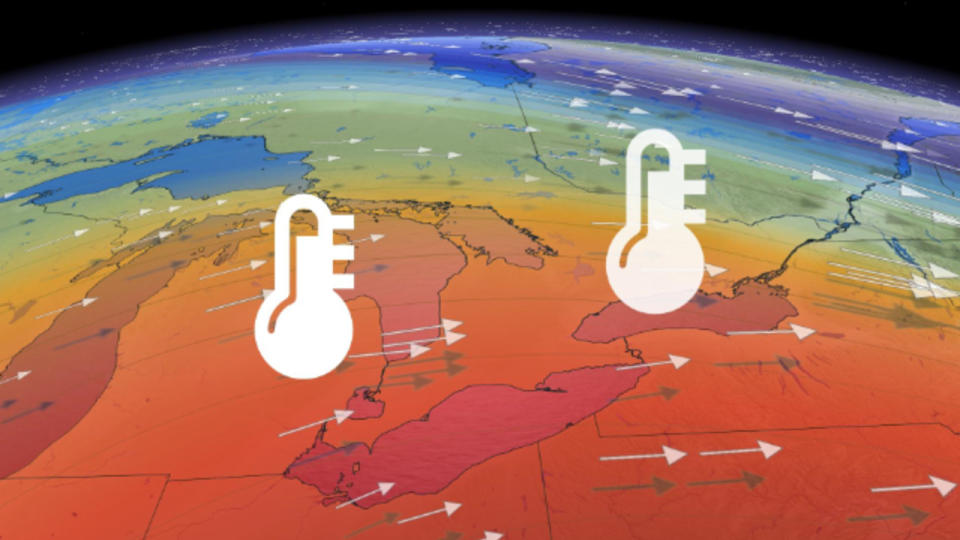
After last week's short, but bitterly cold shot of Arctic air, mild conditions are set to flood the Great Lakes again. That's as winds turn southerly early this week.
MUST SEE: Three things that made the Eastern Canada cold snap so bizarre
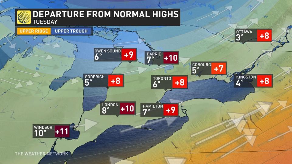
"Some areas may even have a brush with double digits on Tuesday," says Michael Carter, a meteorologist at The Weather Network.
But with a big temperature swing, often comes some unsettled skies, and this surge of milder air will bring widespread precipitation this week.
The first low pressure system will slide across the province on Tuesday and bring primarily rainy conditions to the south. For higher terrain areas along the escarpment, a few millimetres of freezing rain is possible, which could lead to some slippery roads, bridges and overpasses.
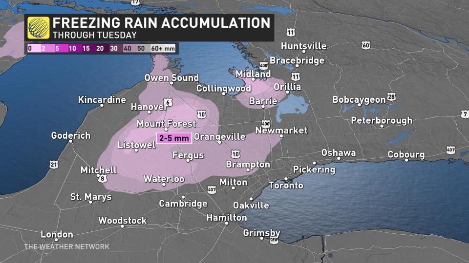
Further north in the Nickel Belt and cottage country, a few centimetres of snow is possible, especially in areas that pick up a little extra moisture from Lake Huron.
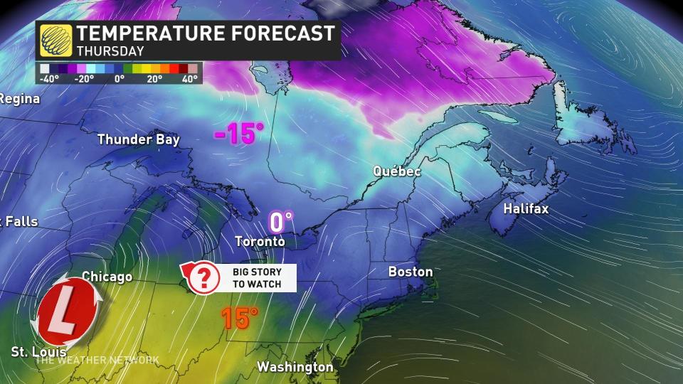
The forecast becomes more interesting by Thursday, as a Texas low draws up a warmer, moist flow from the U.S. deep south. With so much warm air aloft, there's a risk of freezing rain across the higher terrain of southern Ontario and a mess is guaranteed to unfold across regions farther north.
Huge differences in model scenarios range from very mild temperatures and rain from a system tracking northwest of the region to a wintry system with a track to the south of the region. Temperatures will soar into the mid-teens in Ohio, but it remains to be seen how far north the warm front tracks.
Hamilton and Niagara have the best opportunity to experience warm, double-digit February temperatures, while Toronto could very well be stuck in a chilly flow off the lake.
A couple more days of seasonal weather is possible by the weekend, but a mild and active pattern is expected for the next week. Forecasters are watching the potential for winter to make a comeback late in the month.
Check back for updates as more granular details emerge for the tumultuous week ahead.
