
 Yahoo Finance
 First snows pushing into Atlantic Canada after July-like warmth
Atlantic Canada’s flashback to summer was nice while it lasted, but conditions are changing in a hurry as a feisty cold front sweeps into the region.
MUST SEE: Warm or wintry? Halloween weekend holds a mixed bag for Canada
A spell of record-breaking warmth sent temperatures in parts of the Maritimes soaring into the mid-20s this weekend, conditions more common of the middle of summer than mere hours from the arrival of Halloween.
Folks across parts of New Brunswick, Prince Edward Island, and Nova Scotia could locally see 5-10 cm of snow by the time the system wraps up.
Temperatures dive as first snows draw near
The leading edge of frigid air sweeping across North America finally pushed into Atlantic Canada on Sunday, sending temperatures falling in a hurry behind the cold front.

Temperatures will drop as much as 15°C over the course of a day as this colder air settles into the region. An active pattern will accompany the arrival of the colder air, setting the stage for the season’s first snows across areas that just saw those summer-like afternoons.
A northern fringes of a low-pressure system developing stateside will begin to push into the Maritimes overnight Sunday into early Monday, allowing precipitation to spill into the region.

Cold air flooding in on northwesterly winds will bring the season’s first opportunity for snow across a wide swath of the Maritimes.
Precipitation will begin in southern areas during the wee-morning hours on Monday, steadily filling in over the Maritimes as the day progresses.
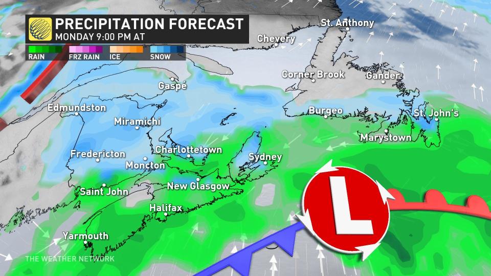
Periods of rain and snow will continue into Monday night before tapering off as the system moves on. Rain and snow will begin to move into Newfoundland through the latter half of Monday.
The greatest chance of snow will fall across higher elevations. Temperatures are likely to stay warm enough for precipitation to stay mostly rain across the southern Maritimes, with some flurries likely in spots.
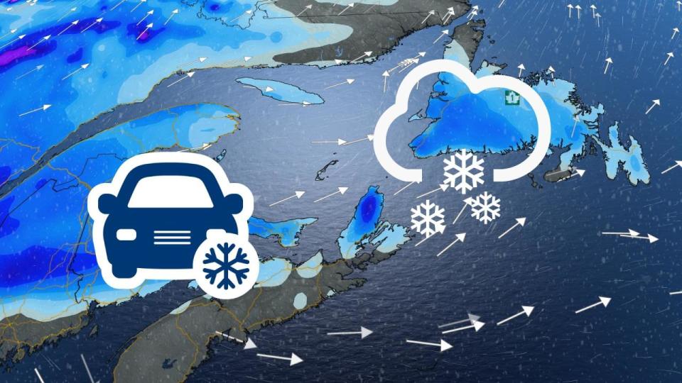
This isn’t going to be a blockbuster snowfall, of course, but the season’s first measurable snow is always a big deal for drivers who haven’t had to negotiate slick roads in six months.
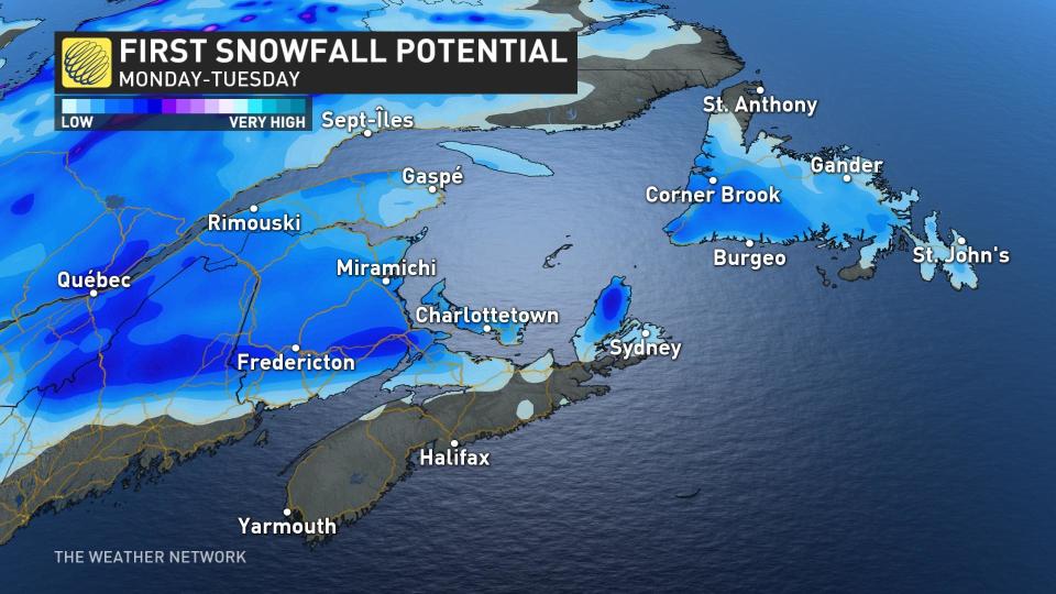
Portions of New Brunswick, P.E.I., and eastern Nova Scotia could see 5-10 cm of snow by Tuesday, with a light dusting possible anywhere else where rain changes to snow.
Forecasters are keeping an eye on the potential for another impactful storm to push into Eastern Canada by the middle of the week, which could bring an additional opportunity for wet snow across the region.
Stay with The Weather Network for the latest updates across Atlantic Canada.
