
 Yahoo Finance
 Risk of flooding persists in some areas following rainfall, high winds
This week's huge rainfall may be behind us, but some local areas remain flooded or facing the threat of rising water.
Parts of Windsor-Essex and Chatham-Kent received as much as 100 millimetres or more rainfall this week, and flooding has been reported along the Thames and Sydenham rivers and Erie Shore Drive in Chatham-Kent.
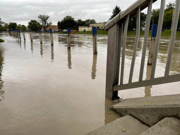
A flood warning remained in effect on Friday for the Thames River. The Lower Thames Valley Conservation Authority (LTVCA) said that in downtown Chatham, the sidewalk along the riverfront has flooded and water levels are expected to peak on Sunday.
The LTVCA says some flooding of basements along King Street could occur late Saturday or Sunday but roadways are not expected to be affected.
Separately, the LTVCA says there's a high wind warning in effect for western Lake Erie and a risk of shoreline damage and erosion all along the lake.
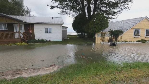
Erie Shore Drive in Chatham-Kent, which flooded earlier this week following high winds, remains at risk, depending on how strong winds become.
Forecasts suggest winds could reach 30 to 40 km/h between Friday evening and Saturday morning, the LTVCA said.
"Residents and workers in the area should be prepared for the possibility of flooding," the LTVCA said in a shoreline conditions outlook on Friday. "There could also be impacts to other low-lying shoreline areas that have seen flooding over the last few years."
The St. Clair Region Conservation Authority says a flood warning remains in effect Friday as water levels continue to rise in parts of the Sydenham River.
The river's levels in Strathroy, Alvinston and Petrolia have begun to fall but they are continuing to rise in the areas of Brigden, Florence and Dresden.
Three roads are closed due to flooding
Fairweather Road between Aberfeldy Line and Oil Springs Line in Township of Enniskillen
Pretty Road between Stanley Line and McCallum Line in St. Clair Township
Waterworks Road between Courtright Line and Moore Line in St. Clair Township
In Windsor-Essex, flood watches have been rescinded but an advisory known as a watershed conditions statement is still in effect due to elevated water levels and the possibility of rain this weekend.
"There is a concern for the accumulation of standing water in low lying areas throughout the Essex Region, especially adjacent to and within floodplain areas of all major waterways and shoreline areas," the authority's said in a statement issued Thursday.
