
 Yahoo Finance
 The ‘bomb cyclone’ hits. Rain drenches Sacramento, prompting fears of floods, mudslides


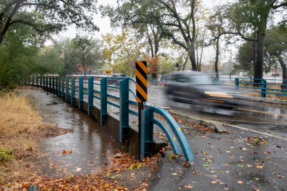


The heaviest rainstorm in years pelted the Sacramento area and the rest of Northern California on Sunday, sparking flood warnings and mudslide alerts for urban and rural residents while evacuation centers were opened in anticipation of disasters.
As thousands of Northern Californians lost electricity, a steady, wind-blown downpour that began early in the day forced the cancellation of at least one major event — the Ironman California race, with 3,500 registered participants — and was on track to establish a new record for one-day rainfall in Sacramento.
An entire southbound lane of Interstate 5 was underwater for part of the day, respite centers were opened for the homeless and motorists were urged to stay off the roads. Sacramento area municipalities handed out sandbags as crews from SMUD and PG&E worked to keep lights on in the face of ever-changing conditions.
As strong as the Category 5 atmospheric river storm was during Sunday, forecasters said the heaviest rain from this early-season “bomb cyclone” wasn’t expected to pound the area until late Sunday night. An urban and small stream flood advisory was in effect until 2 a.m. Monday for Sacramento, El Dorado Placer, Sutter, Yolo and Yuba counties.
“There’s definitely still a lot of rainfall moving into our area,” the National Weather Service’s Katrina Hand said Sunday afternoon.
At the higher elevations, forecasters expected 2 feet of snow in the Sierra Nevada. All told, the precipitation was expected to last through Tuesday.
Meanwhile, the weather service also issued flash flood warnings for “burn scar” areas where vegetation was stripped clean by three of the largest wildfires of 2021 — the Dixie, Caldor and Beckwourth Complex fires. Among the places that could see flooding or debris flows is the Grizzly Flats area of El Dorado County, much of which was destroyed in the early days of the Caldor Fire.
The forecast called for 5 inches or more in Sacramento, putting the storm on track to eclipse the city’s record one-day rainfall of 5.28 inches April 20, 1880. Record or no record, it was shaping up as perhaps the largest storm to hit the area since the historic rainy season that officially ended the last drought in 2017.
The storm was all the more remarkable for taking place in late October, when the California “water year” is just getting going and rainfall is usually light. Hydrology experts said much of the rain was expected to soak into soils that have been dried out by two years of unrelenting drought. That means the state’s beleaguered water supply won’t improve measurably, at least not right away.
“This is really a nice start,” said water expert Jay Lund of UC Davis. “It’s not enough to end the drought.”
Added Jeffrey Mount of the Public Policy Institute of California: “It’s not a drought buster.”
Climatologists say severe rainstorms like this could be a glimpse of California’s future as climate change intensifies. According to a 2018 study published in the scientific journal Nature Climate Change, global warming won’t just worsen droughts; it will bring a phenomenon known as “precipitation whiplash” in which extended dry periods alternate short but intense rainy winters.
Still, the storm through Sunday afternoon produced impressive precipitation totals. At Sacramento Executive Airport, for example, saw nearly 3 inches of rain for the 24-hour period ending at 3 p.m. Midtown Sacramento and the eastern suburbs received a little more — hovering between 3 and 3½ inches.
Foothill communities were hit and miss in the same period: Roseville saw 2.25 inches while El Dorado Hills received 7.49 inches, according to automated gauges collected by the National Weather Service. Other Sierra communities saw most precipitation totals between 3 and 5 inches — Blue Canyon, a typically wet weather spot, had 6.31 inches in the 24-hour span.
The Truckee River was expected to rise to flood stage levels just before midnight, according to the federal California Nevada River Forecast Center.
Points north and west of the capital also received a heavy deluge — Marin and Sonoma counties received upwards of 7 inches while spots in the north state, including Chico, saw more than 5 inches fall.
Parts of Sacramento vulnerable to flooding
For now, the storm was enough to remind Northern Californians that winter can bring flooding. Sacramento is widely considered the second-most flood-prone city in America, after New Orleans, and local officials have scrambled in the past 15 years to fortify levees and take other measures to defend the capital city.
Nevertheless, some parts of greater Sacramento remain vulnerable, particularly those hard-fast by creeks and streams. By mid-morning Sunday, Sacramento County officials announced they were opening an evacuation center at Creekside Adult Center for Arden Arcade residents “that may experience flooding from local creeks and storm drainage areas.”
Arcade Creek, a tributary of the Sacramento River, was swollen with rainwater along Winding Way at Walnut Avenue near American River College — an area prone to flooding.
The roadway was in danger of being flooded as the creek rose by several feet over the course of just a few hours. Between midnight and 2:30 p.m., the water had risen by more than 8½ feet, hitting triggering a flood monitor stage.
South Sacramento CHP officers warned drivers in the region to lower speeds due to the stormy conditions. Travelers on Interstates 5 and 80 saw low visibility and sometimes backed-up traffic as motorists drove through the flurry of rain.
The city of Sacramento opened two respite centers for the homeless — the City Hall lobby and the Hagginwood Community Center on Marysville Boulevard. Sacramento County opened respite centers in the lobbies of two Department of Human Assistance offices, on 28th Street and Florin Road.
Homeless advocates and others ripped. city officials for not opening warming centers after four homeless people died amid a major storm last January. The county coroner, Kimberly Gin, said none of the deaths were weather-related, but the city has since loosened its policy on opening overnight warming shelters.
For property owners preparing to take matters into their own hands, the county announced that sandbags were available at the Citrus Heights and Folsom city halls, behind Folsom’s Fire Station 36, and at three locations in the unincorporated county: Branch Center Road, Westside Park in Rio Linda and the Orangevale Community Center.
The problems weren’t confined to greater Sacramento. Jan Null of Golden Gate Weather Services, a private forecasting firm, called the storm the most intense in the Bay Area in 26 years, and the third strongest since 1950.
In areas affected by wildfires, the threats continued to mount.
Authorities ordered mandatory evacuations for parts of San Mateo and Santa Cruz counties Sunday morning due to dangerous debris flows expected in areas scarred by last year’s CZU Lightning Complex fires. The evacuation areas include spots near the Santa Cruz Mountains.
Nevada County issued evacuation warnings for areas west of Colfax that burned in this summer’s River Fire.
Mudslides in wildfire areas can be extremely dangerous; more than 20 people died in such debris flows following the 2017 fires in Southern California.
In the Grizzly Flats community and other areas burned during the Caldor Fire, for example, the Forest Service warned that fires can turn the soils “hydrophibic” — meaning they can repel water and exacerbate debris flows. The agency said fire personnel were cleaning culverts and installing “straw wattles” — fiber-filled mesh tubes designed to slow the flow of water downhill — throughout the burn area.
“We are very concerned about debris flows in the burn scars,” said weather service meteorologist Anna Wanless.
Mudslides close north state highway
Travel in some parts of Northern California grew increasingly hazardous. Mudslides near the Jarbo Gap area forced the closure of Highway 70 in Butte County east of Paradise, sheriff’s deputies said.
Donner Pass Road, also known as Old Highway 40 was also closed between Truckee and Donner Summit as rocks and other debris were scattered into the roadway, according to Truckee CHP officials.
In the Pocket and Greenhaven areas, the southbound lane of I-5 was closed due to flooding.
The storm sent many to the hardware store for rakes, leaf bags and other necessities. At Emigh Hardware, on El Camino Avenue in Arden Arcade, store manager Randy Aspinall said many customers stocked up in the days before: “We had everybody trying to get prepared for the storm.”
Store traffic actually lightened up a little Sunday, but he was preparing for another wave as storm-related power outages developed. “Then they all come in for flashlights,” he said.
Right on cue, there were blackouts large and small. More than 27,000 homes and businesses were left without power in North Highlands after a car hit a utility pole Sunday morning, said SMUD spokeswoman Lindsay VanLaningham. Their power was restored by early afternoon.
PG&E Corp. was dealing with scattered blackouts, too, including one that darkened more than 5,000 homes and businesses in Tiburon for part of the day. More than 2,000 customers were without power Sunday afternoon in the Nevada City-Grass Valley area, and several hundred in the Oroville area.
The biggest cancellation of the day was the California Ironman race set to begin at Sutter Health Park in West Sacramento.
“It is what it is,” said Mike Bogenar, a triathlete from Wisconsin and one of 3,500 contestants who registered for the event. “You can’t control the weather.”
Also canceled was the Outlaw Music Festival, planned to take place at the Toyota Amphitheatre in Wheatland. Willie Nelson and other country music performers were scheduled to perform, but forced to cancel their show at the open-air venue.
The Bee’s Michael McGough, Daniel Hunt, James Patrick, Rosalio Ahumada and Nathaniel Levine contributed to this report.
